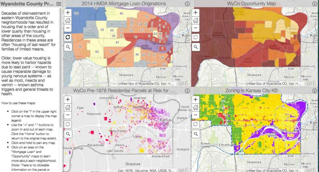
The following maps look at opportunity areas in Wyandotte County and show, on a neighborhood level, areas of opportunity and where those areas overlap. The ‘Legacy’ maps are from the original project and H.E.A.T. Report released in 2016 alongside our funding partners and The Kirwan Institute for the Study of Race and Ethnicity at Ohio State University.
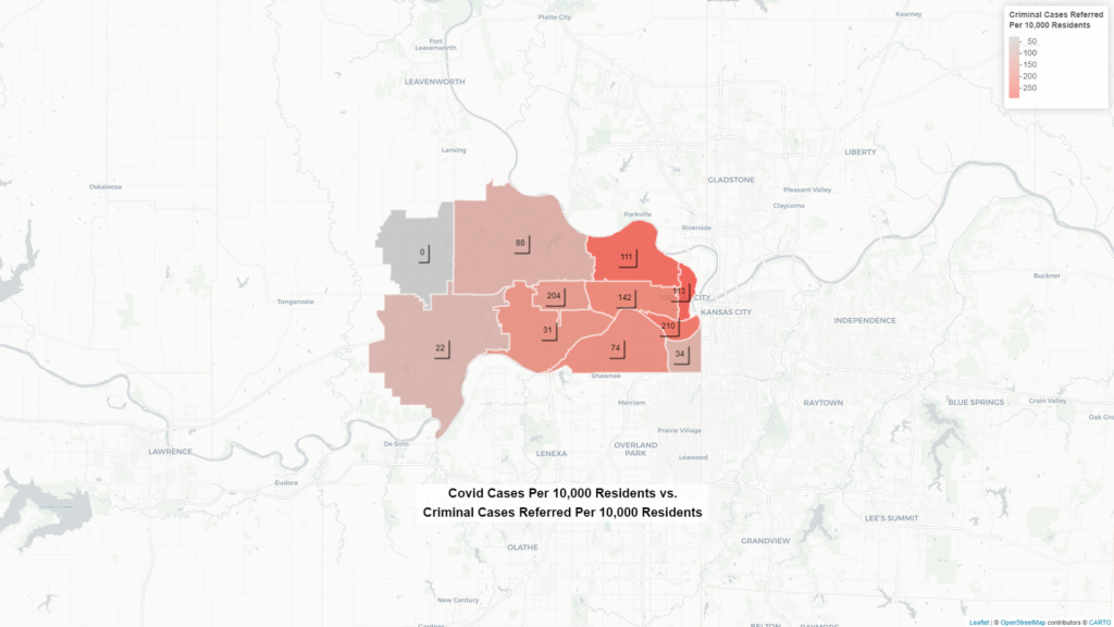
In 2020 the Community Health Council of Wyandotte County partnered with UMKC Center for Economic Information to provide updated maps and the Vera Institute of Justice to include a map comparing cases of Covid-19 and Criminal Cases referred by the County District attorney’s office.
Want to Help Wyandotte’s
Oppressed Neighborhoods?
2020 Key Findings (Summary Page)
In two of the past five years, 2016 and 2020, Wyandotte County has ranked last of the state’s 105 counties for social determinants of health, according to the annual County Health Rankings published by the Robert Woods Foundation (the county ranked last in all five years 2010-2014). Click on the Key finindgs above for a summary, and then dive in to our in-depth story maps below.
- Vulnerable Populations in Wyandotte County
- Wyandotte County, KS – Race/Ethnicity (2010) & Home-Owners Loan Corporation Map
- Wyandotte County Property Characteristics
- Leading Causes of Death in Wyandotte County
- Vulnerable Populations in Wyandotte County
- Opportunity and Race
- Wyandotte County Property Characteristics
- Leading Causes of Death
- KC Metro Home-Owners Loan Corporation (HOLC) Map and Present-Day Race/Ethnicity


